Tuesday, August 12, 2008

Colorado Trip 2008

Well, we managed to squeeze in a 10-day trip to Colorado to visit Mary Ann's parents in the midst of our busy work schedules. Highlights of the trip...

Fri, Aug 1 - Drove 1,000 miles to Fraser, Colorado. The drive was smooth and uneventful (no snafus with traffic, accidents, road construction, weather, deer, moose, elk, avalanches, you know... the usual stuff in Colorado). Got in at 12:45am. Long drive. We were tired, but we got it behind us.

Sat, Aug 2 - Relaxed, unpacked, and took it easy. I ran 10.8 miles at 9,500' on the dirt roads up above the house towards the Devils Thumb TH (out and back, twice). Running at that altitude is not easy, but the air is so clean, the temps cool, and the scenery so beautiful.

Sun, Aug 3 - I got up early before church and ran 20.8 miles on the Fraser to Granby Trail (dirt trail; out and back, twice). Even though it had few hills, that was one tough long run in thin air (8,400'). It was a bucolic run through the open country of Fraser Valley. At one point (actually four times on my double out-and-back run), the trail goes through a cow pasture and I found myself running among a herd of Black Angus cattle (with no fence separating us). A while later, I saw a big hot air balloon take off. I was out there long enough to see four freight trains lumber on down the tracks. Great run. Felt good.

That afternoon after church, all the ladies went up to see a play in Grand Lake.

Mon, Aug 4 - I got up early and ran 10.8 miles on the dirt roads above the house again. Then I had to get myself over to the Denver airport to fly home to teach at CBU that night.

The rest of the family took a hike up to Columbine Lake. That is one gorgeous mountain lake. I wish I could have been there. It sounded like they had plenty of fun there.

Tues, Aug 5 - I got up early and ran 10 miles (with 4x1mile repeats) at the gym in Riverside as soon as the doors opened (4:30am). I had to do that early to have time to catch my flight back to Denver. After running some errands in Denver, I drove back to Fraser Valley. I was disappointed with my early morning run (because the gym was too hot) so I decided to run some more miles on the Fraser River Trail, a paved bike trail which runs south (uphill) from Fraser to Winter Park Ski Resort. I pushed the pace pretty well for the 5.2 miles up to the base and then the 5.2 miles back down to Fraser. The run served as a good benchmark for my pacing since there were mile markers painted on the trail. That is one gorgeous route to run.

While I was gone, Mary Ann and the kids enjoyed a fun-filled day making crafts out at the YMCA Snow Mountain Ranch. They had a big time making bracelets, necklaces, and pottery.

Wed, Aug 6 - I got up early again and ran 10.8 "easy" miles on the dirt roads above the house again. I tried to keep the pace easy since I had a race coming up on Saturday, but it's almost impossible to run an easy run at 9,500'. But at least I didn't spike my heart rate on the uphills this time.

We spent the rest of the day over at the Winter Park Ski Resort. We were racing down the alpine slide, climbing the rock wall, jumping on the bungee-trampoline, and playing miniature golf. That was seven hours of fun!

Unfortunately though, on the way home going up County Road 8, we came around a blind corner and came face to face with an ATV barrelling downhill on the wrong side of the road (cutting the corner while assuming that no other vehicles were on the road). We both slammed on the brakes but still hit. Fortunately, no one was hurt or thrown from the ATV. But still the ATV dented in the passenger-side bumper of my car. Now I have the joy of getting that fixed and settling matters with insurance.

Thurs, Aug 7 - I got up early again and ran another 10.8 "easy" miles on the dirt roads above the house. Two more days before my half marathon in Georgetown.

I then took the kids to Denver to the Rockies-Nationals baseball game at Coors Field (1:05pm start). Cheap tickets were easy to find on the street for this afternoon weekday game. We sat up in the upper deck above first base on row 20. That's a special row because the seats on that row are all purple (compared to all the other seats in the stadium which are dark green). But that row is distinctly purple because it's the "mile-high" row which officially marks 5,280' above sea-level in the mile-high city. Unfortunately, the Rockies (the current reigning NL champs) lost 6-3. They did score 3 runs in the last 2 innings to make it exciting but couldn't pull ahead.

Since Wednesday's game had been rained out, 20 minutes after the first game we got to watch a double-header make-up game. For this second game, over half the fans left leaving the 40,000-seat stadium noticeably empty. There couldn't have been more than 5,000 fans in the entire ballpark. Even in the upper deck, we could clearly hear all the sounds of the game... every catch of the ball, not just the pop of the fastball pitches.

After 3 or 4 innings, we went down to the lower level and asked an usher if we could sit in the lower seats in the later innings. She said, "Just come on in right now. It's a make-up game and there's plenty of empty seats." So we went in and sat about 20 rows from 3rd base. Then after a half inning we moved to some empty seats on row 5. Then after another half inning, we sat on the front row closest to third base right next to the visitors dugout. I told the kids, "Soak this up, kids, I can't afford these kinds of tickets!"

We were so close to the game that we could see every minute detail... even shoe laces and blades of grass. At the end of one inning, the Rockies third-base coach walked over and handed my son a game ball. He was thrilled. So we spent the second half of the game watching from some of the best seats in the house. Unfortunately, the Rockies lost the double-header by the same score (6-3). But we did get to see Matt Holiday hit a massive home-run, and the kids thoroughly enjoyed the close-up experience.

Fri, Aug 8 - I didn't run because I wanted to rest my legs for the race the next day. Instead, I got up early to go bag a 14er. My son was supposed to go with me, but he way overslept. Of course, that was partially my fault after 6 hours of baseball the day before.

We were planning to go up Quandary Peak (14,265') just south of Breckenridge. It's one of the easiest of Colorado's fifty-four 14ers. It's a pretty simple 2.7-mile class-1 hike to the top (although it goes up 3,000' of elevation).

Since I ended up doing this alone, I thought why not attempt an easy 14er with less of a drive to a trailhead. So I pulled off I-70 at exit 221 to attempt the Grays-Torreys double (8 miles rt hike). I started up the 3.5-mile dirt road to the TH. I wondered why there were quite a few cars parked down below, three miles from the TH. I went around the first bend of the dirt road and soon discovered why. This was the gnarliest dirt road I had ever laid eyes on. It went steeply uphill... and I'm not exaggerating when I say it was probably a 20% grade! Not only was it steep, but it had a deep gully that ran diagonally across it. I quickly realized that my Toyota Highlander was not beefy enough to keep from getting stuck. So I turned around and headed to the Quandary Peak TH 35 miles away.

The most difficult thing about hiking Quandary Peak is sorting out the different possible trailheads at the beginning of the hike. According to Gerry Roach's Fourteener book, the main trail is a mile up the turnoff. But actually, that's just a logging road and the main trail is well marked much closer to Hwy 9. Since I didn't know that, I followed Roach's TH (actually a logging road) and started up the trail. Soon I came to a junction and realized only now was I hiking on the main trail. At this point I tried to make some mental notes of the surroundings so I could find my way back to my car afterward.

All the trails had converged into a single line before I got to treeline (~12,000'). I got somewhat of a late start up the trail (roughly 9:00am) but I still had plenty of time to get up and down without the threat of afternoon thunderstorms.

I headed up the trail at what felt like a very slow walk. The trail was steep, but I also wanted to be careful not to spike my HR or wear out my legs before my race the next day. I just wanted a nice little walk to the top of another 14er (my 8th in Colorado).


As I was heading up the East Ridge trail (a very simple, straightforward route which doesn't even have any true switchbacks). There were some low hanging clouds which blew across the summit, but nothing threatening. After only a couple hours on the trail, I was on top. The clouds reduced visibility down to only 300'-500'. I couldn't even see across the valley to the south to Mts. Democrat, Lincoln, and Bross (my first 14ers back in 2003). But still it felt good to be on top.

I gave Mary Ann a call to let her know how it went. I took a few pictures. I talked with a few of the dozen or so people on the top. There was somewhat of a somber mood on top though because the day before the body of an experienced hiker had been found on the south side of the mountain. He had come up a different route and was climbing on some rocks off the trail when he fell. RIP.

I headed down the trail and took some pictures of some of the pikas scurrying around on the rocks and chirping as I passed by.
I wondered if I would find the right trail back to my car. Nope, I didn't. I tried several trails but none of them seemed right. So I emerged from the main trail on the road about a mile below where my car was. Oh well. It still felt good to notch another 14er in my hiking belt (my 8th in Colorado and my 4th for the summer)... although I really wish my son had gone with me. He could have done this one (his 2nd 14er) very easily, and I would have enjoyed his company.

Sat, Aug 10 - This was the day of my big race, the Georgetown to Idaho Springs Half Marathon. This was going to serve as a big test towards my fitness for the Big Bear Marathon on Sept 6 (4 weeks away). I was glad I had a chance to acclimate in Colorado for a good week before attempting this. Even though the p2p course drops 1000' in elevation, it would still be a tough run in thin air (the start in Georgetown is 8500' and the finish in Idaho Springs is 7500').

Since this was also the day that our family would start our return trip to SoCal, the original plan was for all five of us to get up early and leave by 5:30am to drop me off in Georgetown for the start of the race. But early on Saturday morning as I loaded the car, my father-in-law graciously offered to drive me over so Mary Ann and the kids could get an extra couple hours of sleep. This was a very kind gesture on his part for his daughter and grandkids since his son-in-law is wacky enough to get up so early and attempt to run that far in the thin mtn air before driving hundreds of miles towards home.

In Georgetown, I met up with three Colorado friends from the RT marathoning forum. It was great to catch up with Dan, Mike, and Carolyn. We ran a warm-up mile and then lined up for the race. My goal was sub-90 (6:52/mile pace). I thought that would probably be a stretch (despite the downhill course) based on my tough tempo run on the Fraser River Trail on Tuesday. But still I'd give it a shot and try to hang on to that pace. I'd have to be careful not to overdo it and burn myself out on the opening couple of miles which circle Georgetown before heading downhill to Idaho Springs.

I can honestly say I ran a very even paced race on the uphills, downhills, and flats. The slight differences in splits below are mostly due to the fluctuating terrain.

Splits:
Mile 1 - 6:34 - Way faster than I planned, but it felt fine though. Perfect weather... low 60s, cloudy with no direct sunlight
Mile 2 - 6:46 - a bit of uphill; and we hit some stiff headwinds
Mile 3 - 6:42 - getting in the groove, still in those headwinds; ten miles to go; so far so good
Mile 4 - 6:21 - luvin' this downhill
Mile 5 - 6:27 - wow, this pace feels very comfortable
Mile 6 - 6:51 - slowed a bit with some flats and slight uphill near Empire (Exit 232 on I-70)
Half Split - 43:30 - wow, I'm on pace for a 1:27:00 and most of the uphills are behind me!
Mile 7 - 6:36 - feelin' good
Mile 8 - 6:38 - still feelin' good; start reeling people in
Mile 9 - 6:28 - still feelin' good; reeling more people in; sun is starting to come out... glad this will be over soon before it gets too hot!
Mile 10 - 6:27 - wow, if I can run a 20:00 last 5K (6:27 pace), I can dip under 1:26!
Mile 11 - 6:30 - still feelin' great... still reeling people in!
Mile 12 - 6:33 - maybe I can still surge and get in the 1:25's by a few seconds
Finish - 1:26:02, surged and beat the runner in front of me in the last quarter mile; dang, just barely missed 1:25:xx... no wait, my chip time is 1:25:58 (6:34 pace)! Woo hoo! Sub-86!

Ran a neg split by 62 seconds (43:30/42:28)... but granted, part of that was given to me by the course.

Ended up finishing 44th overall (out of 2000+ runners). Not bad for this low-lander from California. Hiking that 14er the day before doesn't seem to have affected me a bit... although I imagine I was the only runner who had stood on a 14er the day before.

I met Mary Ann and kids at the finish. I was pretty excited about my performance. I had exceeded my goal by 4 minutes. They were excited that we still had time to go to McDonalds for breakfast. :-)

And so we hopped in the car and drove 9 hours (600 miles) to St George, Utah after the race... not exactly, the best way to recover from a race, but sometimes that's all the schedule will allow. In the drive afterward, it suddenly dawned on me that with this race I had managed to qualify for the NYC marathon (not that I have plans to run it this year). I sometimes forget that I'm 40 (and have a different required QT) because I refuse to act like it. :-)

We pulled into St. George that night and I ran 5 miles to help my legs recovery. As I was running, I thought some of the sights looked familiar. I suddenly realized I was running on part of the St George Marathon course (where I got my first Boston qualifier 3 years ago). It felt good to swim in the hotel pool with the kids afterward. And we made it back to Riverside the next day.

Another great trip to the mountains of Colorado.

Thursday, July 31, 2008

Whitney and Muir

Being the highest point in the 48-contiguous states, Mt. Whitney, near Lone Pine, CA, is many a hiker's goal. Since I've already done it twice (2003 & 2004), I really didn't have any plans to hike it again. Don't get me wrong, it's a great hike and goes through some beautiful Sierra high country, but there's too many other hikes in the Sierra I haven't had a chance to attempt yet.

But my colleague Tim (a poli-sci prof) asked me last year (2007) to go with him up Whitney since he had never been up there before. He didn't have to twist my arm to get me to agree. He trained well for it on local trails, but unfortunately, in 2007 we failed to get up there on top of Whitney. We secured a permit through the February lottery, but a family funeral out of state ended up being the same day of our permit. Then I got us another permit for the end of August (from a cancellation). We camped in Whitney Portal ready to hike, only to get rained out by incessant storms (the remnants of Hurricane Dean).

So in 2008, I was determined to see Tim get to the top of Whitney. We secured our permit in the Spring. Tim trained throughout the summer. On Tues, July 29th we headed to Lone Pine. We camped in campsite #23 in Whitney Portal (which ironically was the exact same campsite my friend Dan would be camping in just a week later for his Whitney hike). We would start hiking soon after 5:00am on Wed, July 30th.

I had three goals for the day (and in this order of priority):

(1) See Tim make it up and back down Whitney. I still felt bad that we didn't make it up Whitney in 2007 after he prepared so well for it.

Since I wasn't sure how fast Tim wanted to hike, I let him set the pace. However fast he wanted to hike, I'd be happy to follow. Tim and I made good time up past Lone Pine Lake (10,000'), Outpost Camp, Mirror Lake, Trail Camp (12,000'), the 97 switchbacks, and Trail Crest (13,600'). We had a perfect day... temps in the 50s, no wind, and not a cloud in the sky. Our pace slowed some as we got into the thinner air above trail camp, but early in the afternoon we were both on top of Mt. Whitney.

Goal #1 - accomplished.

(2) Climb up Mt. Muir (14,012'). Me and Mt. Muir have some history. It's just a short 300' class 2-3 climb off the side of the main Whitney trail. It should only take about 10-15 minutes to complete, but yet less than 1% of Whitney hikers ever attempt Muir for a double-14er day.

In 2003, I attempted to bag Muir but I felt too unsure of myself when I got above the class-2 scree. Then in 2004, I attempted it again. I tried following a friend (who is a class-5 billy goat) as he quickly hopped up that short climb. But I got too nervous about the exposure on the class-3 part of the climb and stopped.

This time around, I was determined to make it up Mt. Muir. Now I had some good class-3 climbing under my belt since I went up Longs Peak in Colorado last summer. Now I felt more sure of myself on class-3, even with some exposure. Prior to our trip, I also did some online research and plotted out the best route to the top.

As we were heading up towards Whitney, I soon found the well-worn path through the class-2 scree leading up to Mt Muir. (It's actually easy to overlook since the west side of Muir from the Whitney trail looks very similar to the other needles and peaks at that point on the trail.)

After bolting up the scree, there were a couple of cheeky little moves on the class-3 stuff, including a short traverse.
But in a mere 12 minutes, I found myself sitting on top of the summit block. (No, I wasn't comfortable standing on it because the drop off the east side is 1,000'+.) I signed the summit log and sat there enjoying my view and glad to finally exorcise the demons of two prior failed attempts on Muir. I took a few pictures looking west across Sequoia National Park and north towards the needles and Mt. Whitney.

Goal #2 - accomplished.

(3) Fly my kite on Whitney. I've always wanted to fly a kite on a mtn peak. Twice in Yosemite I've attempted this (once on North Dome and once on Half Dome). Even though I tried for hours, neither time was I successful in my attempts to get it in the air. On North Dome, I had no wind at all that morning and on Half Dome the winds were too erratic to keep it airborne.

So I packed my kite in my backpack as Tim and I headed up the trail. Even though the kite collapses down to roughly 1" in diameter, it's still over 3' long and stuck well out of the top of my backpack like a quiver of arrows. I got lots of questions and comments about it as I hiked up the trail. I looked like Big Chief Flying Kite as we ascended the trail.

On top, I assembled the kite and discovered I was missing one of the small sticks. I still tried to get it airborne. I got it up a few times, but it was difficult to control and it quickly spun to the ground.
It's much easier to fly it at the beach with constant, sustained winds in a single direction. I tried for a good while and then realized it just wasn't gonna happen. Oh well. It would have been really cool to fly a kite on the highest point in the 48-contiguous states. I guess I'll have to hike Whitney another day and attempt this again.

Thursday, July 17, 2008

Another great time at the Y

2008 marked the fifth time that our family has camped in Housekeeping Camp in Yosemite for a week. This time around, we had the largest group yet... not just the five of us from our family, but 43 more friends from Riverside (and Texas). Our friends (the DuCasses) who organize the trip managed to secure 12 campsites that were the closest to the Merced River... the most desirable spots in the campground.


Highlights of the trip:

Fri, July 11 - Driving 400 miles and setting up camp.

Sat, July 12 - Rafting on the river. (I got up early in the morning and ran a 10-mile round-trip route to/from Bridal Veil Falls. That is one beautiful trail on which to run.)

Sun, July 13 - Hiking Yosemite Falls. This is a strenuous 3.5-mile climb up 3,000' of elevation to the top of the highest waterfall in North America. Our family (along with 11 others) progressed up the trail. We all ended up spread out on the trail according to our paces. But in a few hours all 16 of us had made it to the top. We all swam in the cold water (but well upstream, nowhere near the edge). Soon storm clouds started forming to the north. We gathered our things and hustled on down the trail. We were drenched with cold rain most of the way down the trail.

Earlier that morning, Lynne and I got up early and ran ~7 miles in Yosemite valley. What was really cool was that we spotted a bobcat over near Yosemite Village. It's back end with on the path with its short stubby tail sticking up in the air. When it poked its head up, it was still holding a mouse that it had just caught for breakfast. Pretty cool. I had never seen a bobcat in Yosemite before.

Mon, July 14 - Rafting on the river again. Another great trip down the Merced, except this time we had to scurry off the river as another thunderstorm approached.

Earlier that morning, I ran my 10-mile route to/from Bridal Veil Falls again. Gotta love that trail.

Tues, July 15 - Hiking in Tuolumne Meadows. Prior to our trip, I had bought my first ice axe and set of crampons. My goal was Mt. Lyell (13,114'), the highest point in Yosemite. The route involved a trek across the Lyell Glacier, a relatively simple glacier to cross that often is used to teach beginners. (It has no life-threatening crevasses or steep slopes.)

The route to Lyell has a long approach. Basically, you hike out 11 miles through a high altitude meadow, before you even leave the trail to begin the 3.5-mile, class-3 climb up to the peak of Lyell.
Most climbers do this as a 2-day hike allow for an early morning climb to the peak. I didn't want to be gone from the family that long so I attempted it as a 29-mile day-hike. I camped the night before (Mon) at Tuolumne Meadows campground to avoid the 90-minute drive to the TH.

I got an early start on the hike, but I didn't realize how many different trails converged in the Tuolumne Meadows area. (I had thought there was simply one trail that went straight out towards Donahue Pass.) I ended up wasting a good bit of time making sure I was on the correct trail. I was enjoying the hike through the meadows, but halfway out I realized I was running out of time to make it up and down Lyell and back to camp at a reasonable hour. (Class-3 climbing goes much slower than hiking, and our family did have to pack up that night to leave the next day.)

So unfortunately, my ice axe and crampons went unused and I decided to not attempt Lyell. Instead, I simply hiked on out to Donahue Pass (11,056') where the John Muir Trail leaves Yosemite National Park on its 212-mile trek to Mt. Whitney. Suffice it to say, I was the only day-hiker out there. Everyone else was on Day 3 or Day 4 of their backpacking trip on the John Muir Trail. (One of these days I'm gonna have to do that.) I thoroughly enjoyed the hike, but I wish I had either had enough time to make it up Lyell or simply run that trail sans backpack as a nice long trail run. Oh well.

Wed, July 16 - Drove home to SoCal. Unfortunately, we were leaving a day earlier than the rest of our friends because Mary Ann had one of her last classes at Cal State San Bernardino. We drove straight from Yosemite to drop her off with paper in hand for her class. But she made it and we had squeezed in a great family trip in the process.

Friday, July 04, 2008

35th place but what a victory!

I ran the 34th annual Coronado Independence Day 15K (9.3 miles) in San Diego again this year. I also ran it back in 2006 (1:02:24 that day). It's a great race. Here's the course map:


And here's my hand-made elevation profile:

-------------------

Ok, races don't get any flatter than this one. There's not a single hill. It's all at sea level starting at Tidelands Park on Coronado "Island"... which really isn't an island but a pennisula (but that's not important right now).

Race day for me started at O'dark thirty... actually 4:15am. Drove 90 miles to San Diego for the 7am start. Big race. Lots of people. I got there an hour before the race start and still had problems finding parking.

I hoped to run sub-60 (6:27 pace)... but here's my splits...
mile 1 - 6:30 uh oh, a bit too slow
mile 2 - 6:09 oops, a bit too fast
mile 3 - 6:23 ah, just right... the Goldilocks zone
mile 4 - 6:20 a bit fast, but nice
mile 5 - 6:43 what the... BTW, this exact same mile split was slow 2 years ago
mile 6 - 3:42 no, just kidding, I missed the mile marker... just checking to see if you're reading :-)
mile 7 - 13:14 or 6:37/6:37... 10sec off pace for those 2 miles
mile 8 - 6:40 maybe I can still go sub-61 for a personal CR
finish - 60:33 (6:30 a mile; missed sub-60 by 4sec per mile)


The last couple of miles were fun because three of us masters runners (i.e., runners over 40) were running side by side, neck and neck. We all three knew it'd be a race to the finish line. One guy took off with a quarter mile to go. I thought he kicked too soon so I let him get ahead a good bit. Then I started kicking. I was closing in on him but I ran out of real estate before the finish line. But I did beat the other guy.

A couple minutes after I finished, I heard it announced that Steve Scott was coming to the finish. Sure 'nough, it was him. I finished 2:27 ahead of him. I was rather proud of myself for beating Steve Scott. Of course, in his prime he could have torched my tail by nearly that much in the mile alone (not just a 15K).

For runners, the name Steve Scott doesn't need any explanation, but for the non-runners realize that he held the American Record for the mile (3:47) for 26 years until Alan Webb broke that last year (2007). He also has run more sub-4 minute miles in history than anyone else (136). My kids thought it was cool that I beat someone who has his own wikipedia page. :-)

Now I'm having too much fun reminding all my family and friends that I beat Steve Scott today (even though I am 12 years younger than him). I remind them every couple of minutes about it. I'm spinning every conversation in a way to make the point that I beat Steve Scott. My son was playing Wii tennis a few minutes ago. He said, "Hey dad, I just beat all the players at tennis." Me: "Yeah, but did you beat Steve Scott?" :-)

And now I'm telling the story with great dramatic effect (and a tad of poetic license )... "I was racing neck and neck with this supreme athlete in the last miles of the race. Neither of us was giving an inch to the other. We were digging deep to outrace each other in those last couple of miles. Steve was running so fast to beat me that he realized he might have to log his 137th career sub-4 mile at the end of this race to get me. But I didn't let him have an inch of the lead. We came flying into the finishing chute side by side and I leaned at the tape and beat him by a hair. He just shook his head and patted me on the back as he realized there was a new kid in town." :-) :-) :-)

Ok, maybe I'm having a bit too much fun with this. I never got to meet him and I didn't run with him, but I did finish ahead of him. Seriously, from all I've heard, Steve Scott is an outstanding person with great integrity and character, and obviously one of the most talented runners in history. He's a great competitor and I wish him all the best with his running, his life, and his career.

This is one of the many fun things about running road races. You never know who might be in the race with you. A mediocre recreational runner like myself might be lining up right next to a former Olympian. A few years ago, I managed to finish the San Dieguito Half Marathon ahead of Paula Newby-Fraser (the "queen of Kona" who won the Ironman World Championships in Hawaii a record 8x)... and someone else with her own wikipedia page. Again, in her prime, all I would have seen is the bottom of her shoes as she would have left me behind.

I discovered after I got home that I placed 3rd in my age-group (M40-44). But I didn't stick around for any awards. I guess I really ought to start doing that since I've missed out on 2 AG awards so far this summer. Hopefully, I'll get the nice polo shirt in the mail for placing 3rd.

Got home in time to enjoy a pool party with friends and see fireworks that night. It was a good day.

Sunday, June 29, 2008

Bristlecone Pines and Boiling Water on White Mountain

There's many different reasons to bag a summit...

White Mountain is often an under-appreciated 14er in California, even though it's the state's 3rd highest. It doesn't have the stand-alone majestic grandeur of Shasta. It's not in the Sierra with all the others. It's the shortest hike for a California 14er, and there's a fire road to the top.

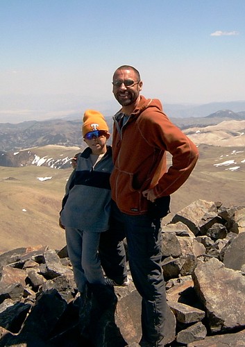
But for the last weekend of June 2008, White Mountain was the perfect peak for my son and me. We were looking for a high, nearby (relatively speaking) peak where we could do his 4th grade science project. For him, it would be a tough but reasonable hike to do... his longest and highest hike yet... and his first 14er. (Click here for complete slideshow of pictures.)

Bristlecone Pines...

White Mountain also had the added attraction of the Ancient Bristlecone Pine Forest. Kids love seeing something that is the highest or biggest or mostest or leastest... and this grove of wind-blown, weather-worn trees offered the oldest... something even big kids like me love to see.

On Friday, we drove 5 hours up 395 to Big Pine and then on up Hwy 168 and White Mtn road. We got to the trees late in the afternoon, but still with plenty of time to do the 4-mile walk on the Methuselah Grove trail. The path leads you to the grove where many 3,000+ year old trees still stand, more than 20 of which are 4,000+ years old. Of course, the Methuselah Tree itself is not identified to protect it from the public, but we sure had fun trying to guess which one it might be. Of course, the great irony of the bristlecone pines is that in 1964 a grad student studying the trees cut down an old one on Wheeler Peak (in Nevada) only to discover later that he had cut down the oldest one! (The Prometheus Tree dated to be at least 4,862 years old, possibly older.)

As we walked among the bristlecones, it was interesting to see small, young seedlings sprouting up. It made me wonder if 4,000 years from now another father and son would be walking in this area remarking, Wow, what an old tree.

Even though my son is only 9 years old, he's a pretty smart kid. He remarked, "And Dad, I know you didn't plant these because then they wouldn't be the oldest living things."

With such resounding confidence in my youthfulness, I decided to cook him dinner and let him sleep in my tent. :-)

Boiling Water...

The main goal of our trip up White Mountain was to do his science project for the upcoming school year. Parents of school kids know how stressful it can get lining up a reasonable and doable project for school. And of course, there's always the friendly competition with the other kids in the class to encourage a creative and unique science project.

Before heading to the mountains, we had read that water boils at 1 degree less for every 500' of altitude gain... and that would be our mathematical hypothesis. It would be interesting to see how it turned out.

On Friday night at Grandview Campground (elev. 8,600') we did our first experiment. My son, who loves math, calculated that the water should boil at 195° (i.e., 212° - 17°). We set up the backpacking stove, and voila, the water came to a full boil at 195°. Pretty cool.

Saturday morning would be our big hike. Before starting, we drove to the Visitor Center parking lot at 10,200'. My son had calculated that the water would boil at 192° (i.e., 212° - 20°). Sure 'nough, water boiled at that temperature. So far so good.

Now to the trailhead. It takes nearly an hour to drive out the winding dirt road to the Barcroft Gate. When you get there, you can't see the summit of White Mountain, and won't until nearly halfway there on the hike. Only then you realize, wow, most of the elevation gain (at least 2,300' of it) is in the last 1½ miles.

So my son and I started off. I was carrying the backpack that carried food, water, cold-weather clothes, and the science project stuff. The first mile is a little steep, but after that the road meanders up and down for 4½ miles without gaining much more elevation. When we got above the Barcroft Research Station, we boiled water at 12,500'. And it boiled at 187° just as he had calculated.

My son was getting tired in the thin air on the uphill grades. But I let him set the pace and take as many rest breaks as he wanted. If he wanted to turn back, that would be his call. But he's a very driven, goal-oriented, competitive kid. (I don't know where he gets that.) A few times, I thought he might say, Enough. But he surprised me. After a rest break, he suddenly looked up, smiled, and said, "Let's knock this sucker out." I couldn't help but laugh at him.

The last big obstacle was a huge, deep snowfield high on the mtn that covered the trail for about 200 yds. We met one hiker coming down who turned around at that point (only 200' from the summit). My son told me later that he thought we wouldn't make it. But I've been on enough peaks to know there was probably an alternate route around it. So it turned into a class-2 climb through the scree at 14,000'. And we made it.

By the time we summitted, word had already spread among those on top that a 9yo boy was on his way up. When we got there, everyone was congratulating him and raving about his hiking ability. And he loved every minute of it.

He was so exhausted that he laid down and quickly fell sound asleep. I let him nap as long as he wanted. The sky was cloudless so we had no storms to beat back to the car. After he had slept and ate, we boiled some more water. Sure 'nough, it boiled at 184° just as he calculated.

At this point, I was wondering how tired he would be for the 7-mile return to the car. But he had recharged his batteries. He talked my ear off on the way back. He was joking and goofing around just like his old normal, playful self... and he rarely took a rest break (except on a couple of steep climbs on the return). I was amazed because this was 6 miles farther than he had ever gone before, and he had rarely been anywhere near this altitude.

And so we did do his science project, testing the boiling temperature at 8,600' and 10,200' and 12,500' and 14,256'. And our working hypothesis was shown correct. The water boiled at 195°, 192°, 187°, and 184°(respectively). It was a really cool experiment for this upcoming school year.

I was very, very proud of my son. I think he learned some huge lessons about self-discipline and pressing on, even when you're tired. I've never seen him more exhausted in my life. But as I mentioned, I never pushed him or urged him to go on. We did it at his pace and he led the way.

And now this only fueled his addiction to hiking. We camped Saturday night at Lonepine Campground near Whitney Portal (the gateway to Mt Whitney). In the morning, he specifically wanted me to take him up to Whitney Portal and take his picture at the trailhead because he wants to hike Whitney as soon as he is big enough. (He does realize it's a longer hike, with more elevation, to a higher altitude.) Of course, this doesn't surprise me. Near the end of our hike to/from White Mtn on Saturday, he remarked (in all seriousness), "That was a nice little hike." I thought, "little"? Makes me wonder what's in store ahead for him.

Friday, June 20, 2008

Backpacking across Zion National Park

Ever since our family stayed at the Lodge in Zion National Park in 2003, this park has been one of my favorites. It's like a smaller, redder version of Yosemite… amazingly steep canyon walls carved by rivers and creeks, but these are red sandstone, not gray granite. It's one of the overlooked gems of the Colorado Plateau due to other more popular parks nearby like the Grand Canyon and Arches.

Like most of our national parks, you only see a tiny fraction of the beauty of the place from the paved roads. The trails of the backcountry are the only way to experience the wonders of a place like Zion. To see my complete slideshow in a new window, click here (click on "options" in bottom right corner to turn on/off descriptions of pictures).

Driving Day (Wed, June 11): 450 miles of driving

I drove to Zion and got there in time to pick up my permits and exchange them for better campsite locations. I camped just outside the park next to the Virgin River.

Hiking Day 1 (Thurs, June 12): 6 miles of backpacking and 8 miles of trail running

I parked my car at the East Entrance and then as arranged, Red Rock Shuttle drove me 54 miles to Lee's Pass at the far northwest corner of the park at Kolob Canyons. Gordon (the driver) was a nice guy who knew lots of stories about southern Utah. As he drove off, I thought, "Ok, I'm out here by myself and 47 miles from my car. Better git 'er dun!"

I backpacked 6 miles down the La Vernkin Creek trail. The trail meanders along and frequently across La Vernkin Creek to the campsites. It took only a couple of hours to arrive at my campsite since it was almost all downhill, even though I stopped often to take pictures. Photographing Zion was a futile attempt to capture the beauty of this place and to try to bring it home to savor.

After setting up camp under a big oak tree at La Vernkin campsite #9. I decided to go for a trail run to see some nearby sights off the main trail. I felt light as a feather without my pack! First, I ran about a mile up to see Kolob Arch. With a span of 287', it is allegedly the second largest natural arch in the world (second only to Landscape Arch in Arches National Park). It's the highlight of this corner of Zion which most hikers in these parts make as their main destination. Due to the time of day with the sun setting behind it, I never could position myself for a decent photograph of the arch (the photo here is not mine). But it was stunning to see in person. The frogs in the creekbed seemed to agree as they croaked a loud chorus upon my approach.

Next I set out to find a waterfall I thought was up Willis Creek. I kept running up the creekbed and across the creek. A small rattlesnake greeted me as I passed by. I thought WWJMD? (What would John Muir do?) So I left the critter alone and marked the trail with pinecones so I knew where to be extra cautious on my return through there an hour later.

I had run a few miles up the creek and it was starting to get late so disappointedly I decided to turn around and head back to camp. I realized afterward that I missed the falls because they were up Bear Trap Canyon which splits off of Willis Creek. Oh well. It still was fun going for a trail run up a creek and through the deep and rarely explored canyons of Zion.

Later that night, I was sitting next to La Vernkin Creek eating dinner when I had visitors. A duck and her seven little ducklings swam and waddled by. A few hours later, I was lying in my tent about dusk when I heard something walking around outside. It sounded too big to be a squirrel but too small to be a mountain lion. It was a wild turkey with three little chicks in tow. It was nice for my neighbors to bring their families by.

Hiking Day 2 (Fri, June 13): 26 miles of backpacking

I slept hard Thursday night and got up at first light and was on the trail early. I knew I had to make good time because this was my longest leg of my trip.

First, I backpacked a mile up La Vernkin Creek trail to the Hop Valley trail. The Hop Valley trail began with a steep climb with switchbacks up to the top of a pass where I could see for several miles up the wide sandy plain known as Hop Valley. The creek was about ten yards wide and no more than about 3" deep. Hiking the 6½ miles through Hop Valley was like hiking on the beach. My feet sank low in the loose fine sand (especially with an extra 45 lbs. on my back). It made for some slow progress, and I found that I was carrying a good bit of the trail with me… in my shoes.

A few miles up the creek, the trail seemed to split and go up a steep hillside through some brush. I stood there for several minutes trying to determine which direction was actually the main trail. My detailed map didn't seem to indicate any trail splitting off. Since it looked more well worn to go uphill, I figured the trail must be bypassing some kind of steep obstacle up the creek. I progressed up the steep hill and through low-hanging branches. Soon I was questioning how this could be the main trail, but there was lots of horse manure functioning like bread crumbs (ok, I admit that's a gross analogy) leading me on higher and further through the brush. I certainly wasn't the only man (or beast) that had come this way. Finally, I was getting frustrated with the relentless scratching of this thick underbrush and I decided to cut across back to the other trail down below in the creek bed. "Ruh roh, Scraggy" I thought as I now stood at the top of a 40' ravine looking at the trail far below.

I stood there for a few minutes weighing my options. Backtrack? No, I didn't have time to waste on my longest hiking day. Lower my pack down and then climb down? No, my pack and possibly myself would get smashed on the boulders below. Search for another way down? Yes, not too far away, I found a place where many other frustrated off-trail hikers had descended to the true trail below. I've never been happier to be back on the main trail.

Soon I had made it to the Hop Valley trailhead. Wow, a latrine (who'da thunk that would be a step up for bathroom facilities) complete with anti-bacterial soap (what a novel idea)! I sat in the shade of the trees and ate lunch.

Next I headed across the Connector Trail. These 4 miles led across softly rolling hills with mostly low brush but some trees. Then came the 5 miles known as Wildcat Canyon trail. This was a wide trail which offered trees for shade now that the day was getting hot. I passed a group of about 15 people who were out on a short day-hike to Northgate Peaks. They looked at me rather odd since I was carrying more gear than all of them combined. I guess they didn't realize that all these smaller shorter trails in Zion could be combined into one long Trans-Zion expressway.

Finally, I came to the West Rim trail. This (combined with the Telegraph Canyon trail) would be my route for what I thought would be the final 8½ miles of the day. After ¾ of a mile, I came across the sign for what would be my last water source for the rest of the day… Sawmill Spring. The spring was about a third of a mile down a hill off the trail. I wasn't even sure if it was running or not. I figured, I'd better fill up with water so I set my pack under a large pine tree and headed down the trail with my camelbak bladder and my water-filter pump. The spring was a tiny bubbling pool of water about the size of the spurt of oil that Jed Clampett had shot out of the ground. Even though the spring sat in the hot afternoon sun, the water was refreshingly cold and tasted oh so good!

By this point of the afternoon, I was counting down the miles (or more rightly the minutes) until I came to the Telegraph Canyon trail which served as a 1½-mile shortcut to my campsite. Unfortunately, there was a long steep climb upward to that much anticipated junction… and when I got there I was rudely greeted with an unexpected sign: "TRAIL CLOSED due to downed trees and erosion." I wasn't too excited about this little detour. After hiking 23 miles with a 45-pound pack to get to this point, I just collapsed under a tree and pondered that sign. Instead of hiking 1.8 miles down Telegraph Canyon trail, I now had to hike 3.2 miles continuing on West Rim trail.

Even though I really wasn't in the mood to add any extra miles to my hike that day, I must admit the views from the West Rim trail were stunning. Most of the way, I was looking down on countless canyons as far as one could see. When I did arrive at my campsite (West Rim #1), I just dropped my pack and laid flat on my back for 15-20 minutes. I've run marathons in rugged places like Pikes Peak, Crater Lake, and Death Valley before, but it's been a long time since I've been that exhausted. Running 26 miles free-spirited and unencumbered is one matter, but hiking 26 miles with a full pack is a whole other matter. I realized 26 miles of backpacking is about my limit for one day. That's good to know.

After inhaling a tasty dinner of rice, beef jerky, and an orange for dessert (all of which pretty much vaporized in my mouth), I insisted that my tired legs take me and my water filter about a quarter mile further down the trail to Cabin Spring (the reason I selected this campsite) to load up on water. That would be one less thing to do in the morning.

That night I had visitors again, but these were not as welcome. Seemingly every mosquito on that side of the park smelled fresh blood. And they congregated on the screen of my tent. I was treated to a gorgeous sunset out the side of my tent as night fell, and my hungry little visitors returned in the morning for sunrise to see if I wanted to come out and play.

Hiking Day 3 (Sat, June 14): 16 miles of backpacking and 450 miles of driving

I went to bed Friday night wondering what my legs would feel like in the morning. I was afraid they might stage a revolt and self-amputate themselves if I tried to walk any further. But I was pleasantly surprised to find my legs awoke refreshed and up for another big day of hiking.

Saturday would be a shorter day in terms of mileage, but it was a day of bigger climbs. I'd be hiking down into the heart of the main valley thousands of feet below and then back up and out of the canyon up the steep walls, up to the East Rim, and on over to the East Entrance.

I started early again, and I proceeded two miles down the West Rim trail to Scout's Lookout. The morning sunrise over the canyons adjacent to the trail was spectacular. It was odd to arrive at Scout's Lookout by mostly going downhill. I had been here three years before after running the St. George Marathon. Scout's Lookout is the last stop on the main trail up from the floor of Zion to Angel's Landing. At Scout's Lookout, there's only the final strenuous and rather exposed ½-mile climb up to the top of Angel's Landing, one of the supreme highlights of Zion National Park. Like I said, I had been here before, but on that afternoon in October 2005, my legs were too tired to go any further after running 26 miles that morning for my first BQ (Boston-qualifier).

But this morning, my legs were fresh so I stashed my pack (no need to take that to the top!) and set off with only my camera to conquer Angel's Landing. Again, I felt light as a feather as I quickly climbed the final 500' to the top… and it is a climb, often on all fours and often with no more than a few feet of room to spare with the valley floor 2,000' directly below. There were a few early-risers who were already up on top savoring the amazing views of the valley in all directions. But what distracted my attention was the sight of the steep switchbacks on the east canyon wall that I knew I'd have to ascend in an hour or two. Normally, I'd relax and spend some time on a magnificent summit like this, but I'd better get going if I wanted to climb those switchbacks in the shade of the canyon wall.

So I darted back down to my pack and quickly descended to the valley floor. I passed dozens and dozens of hikers who again gave me strange looks as I descended this popular trail with a full pack. As I approached the footbridge crossing the Virgin River, a herd of five deer waded out into the river. I pointed these out to hikers I passed, most of whom were too oblivious to have noticed for themselves the wildlife right beside them.

I crossed the footbridge at the Grotto and headed 1½ miles up the main road to Weeping Rock. It felt odd to be backpacking on a paved road, but the only vehicles were the park shuttle buses ferrying visitors to the various highlights of the valley floor. Would I ease my feet and ride the bus to my next trail junction? Nah, that would be cheating. So I just waved a friendly wave as I headed up the road… and I spared the bus riders the strong scent of "Ode of Wilderness."

About ten minutes up the road, a shuttle bus passed, and no sooner had it done so and a big buck jumped out in the road about 10 yards ahead of me. He just looked at me cock-eyed as if to say, "You're not supposed to be there! The bus just passed. What are you doing here?" And then he dashed off the side of the road to his friends below in the river.

Weeping Rock serves as the trailhead for the East Rim trail and Observation Point. Five years ago, I had gone this way before. I had power-hiked the four-mile trail to Observation Point… but I was carrying only a tiny day pack with a small amount of water that day. Today would be different.

Fortunately, I was graced with the cool shade of the shadows from the east canyon wall as I hiked two miles and up several thousand feet in elevation. I felt like a tractor-trailer in low gear as I ascended the reasonable grade of the switchbacks. Above the switchbacks, for a short while the trail meanders through and above several mesmerizing slot canyons that are so characteristic of Zion. I couldn't help but think, I can't wait to come back here sometime and hike the Narrows (the most famous slot canyon in Zion) with my wife and kids. That's the most popular hike in the park, and something that would interest them much more than a 3-day, 47-mile backpacking trip.

After the trail for Observation Point split from my route on the East Rim trail, I rudely discovered that I had a lot more elevation to gain. And it was hot. The sun had been scorching these shadeless slabs of sandstone that now served as my path. The route was hot, steep, and relentless. The only consolation for this draining grind was that the temperatures would get cooler as I ascended in elevation… supposedly, but I didn't seem to feel it. Across these rocks, the path was obscure and difficult to trace, but cairns had been built to dot the route as trail markers.

I was sweating profusely as I sucked in hot dry air and guzzled cold water while laboring with my pack up to and on top of the East Rim itself. The trail leveled off and now provided the cool shade of large trees that adorned the edge of the canyon rim. Two days ago, I was shutter happy as I paused to snap up pictures of canyons like these. But now, I knew I was on the final leg of my journey and within a couple of hours of my car so even the beauty of the East Rim couldn't slow me down much.

After traversing a large treeless meadow, I found myself at Stave Spring, the last water source on my hike. I thought I probably had enough water to make it to the car with no problem, but I had used so much already I figured it wouldn't hurt to fill up. So I did.

It was a good decision because the rest of the trail was a shadeless descent on a wide barren trail that was baking in the afternoon sun. I applied copious amounts of sunscreen and tucked a bandana under my hat to serve as a shade for the back of my neck. Soon down the road, I was treated to the trickle of cold water down the back of my pants. I thought, "That feels good! No, wait a minute? I'm not supposed to be feeling that!" I discovered the tubing of one of my camelbak bladders had disconnected and drained itself in my backpack. Nothing I could do about it now… and I'm glad I had second one in there.

Since there's no mile markers on trails like these, I was calculating in my head my estimated time of arrival for the last five miles of the hike (based on my pace from the previous days). Two low-flying vultures circled overhead. I thought, that's not a good sign. Good thing I'm not superstitious. It didn't dawn on me til afterward that yesterday was Friday the 13th.

Slowly the miles ticked off… they seemed extremely drawn out since I'm used to running... but without a pack. It was as if time was in slow motion. But I was making progress. No sooner had I calculated that I probably had one mile to go than I rounded the bend and there was my car! "Yes!" I shouted and I've never been happier to know I had misjudged my finish!

I wasted no time as I loaded up my gear and headed off down the road. I had thoroughly enjoyed Zion, but I was ready to head for home. Tomorrow was Father's Day and I really wanted to get home to see my wife and kids that night. And seven hours later I did. It was an awesome, awesome backpacking trip, but it was good to be home… back to the land of soft beds, indoor plumbing and running water.

Sunday, June 08, 2008

Running the mountains of Santa Monica

Well, I ran the Valley Crest Half Marathon, a tough hilly trail race, in the Santa Monica mtns this weekend. Unfortunately, the morning fog burned off just before the 8am start and we were treated to the warm California sun, but at least that allowed us to see the beauty of the Santa Monica mtns in all directions.

Tough, tough hills. There's a reason there's no paved roads in this area! This is one of those fun, scenic races that you go and give your best effort but you know your finishing time is going to be well off your PR (unless you have a very, very soft PR).


I figured since I ran 1:30:23 for a half in the hills of Palos Verdes a few weeks ago (878' elevation gain), maybe I could run 1:35 on this course that has nearly twice the elevation gain (1,642'). I knew that'd be a tall order. Actually, I think the course eats up much more than 5 minutes off of a normal half time. I found out afterward, that the course-record holder from last year ran 1:13 (in better weather... cool & overcast) and he's a 1:04 half marathoner.

Ready for my splits? Here they are:
13.1 in 1:37:58
finish in 1:37:58
There were no mile markers. :-) You just go and run your heart out.

I can say I made a good consistent effort and paced myself well. No one passed me on the second half of the course, and I managed to pass a couple of runners in that same stretch. So unlike Palos Verdes, I didn't fade any at the end of this race. Mile 12 was brutally uphill and then the closing ¼ mile was brutally downhill to a disadvantage (having to brake and keep from sliding on the dirt).

I think I finished 19th overall. Overall, it was a great race in a great place. Glad I did it. You just gotta love races like this.

Sunday, May 18, 2008

Running the hills of Palos Verdes

When our family visited Palos Verdes for the first time back in April, I realized I really need to run the Palos Verdes Marathon sometime. That's one beautiful place to run a race. Basically, the Palos Verdes Marathon is SoCal's version of the world renowned Big Sur Marathon in NorCal.

When May rolled around, I had to decide full or half? Full or half? I was really wanting to run the full marathon at Palos Verdes to fully experience the place. I also prefer to run the longest race when an event is sponsoring more than one race. Normally, when I run a half marathon, it's a stand-alone half marathon (not just a shorter event being offered at a full marathon).

But since my training had been minimal due to injuries (only 8 weeks of solid miles in the 50s or 60s) and I hadn't run a race (due to repeated nagging injuries) in over a year (since last year's debacle at Boston), I opted for the half. Turned out to be a wise decision for other reasons. A high pressure system moved over SoCal the weekend of the Palos Verdes races. Normally, the afternoon high is supposed to be 72° in mid-May. But weather.com was predicting the following temps for race day:
7am - 69° sunny
8am - 72° sunny
9am - 76° sunny
10am - 81° sunny
The full marathon started at 7:00am and the half at 7:30am. I was very glad I had chosen the half. It was 78° when I finished around 9am. Those full marathoners must have really been suffering out there in the heat.

My training was only minimal going into this race. My last eight weeks of miles had been: 50, 51, 52, 62, 62, 64, and 71. My long had increased in those weeks: 11, 13, 17, 20, 18, 21, and 21. But still, only 6 times in those 2 months had I run farther than the half marathon distance. Also my four tempo runs had only been 6 miles each. I knew that meant I was probably not going to have a strong finish. But still I would give it my best effort.

Going back to 2004, I had a string of half marathon races in which I had always run sub-1:30 (or sub-90 minutes which is 6:52/mile). I really didn't want to see that streak come to an end. I knew it'd be really tough to run sub-90 on a sunny, hot day on this course which is far from easy... 878' of total elevation gain! There are lots of hills on this course.


Ready for some erratic splits? Here you go. BTW, the question mark means I missed the mile marker and had to split the difference with the next mile. Also realize that the elevation only indicates how high the mile marker was. There were hills in between all those mile markers too. I actually felt like I gave a very even effort up and down the hills (even though the splits don't look like it) until the last 2-3 miles.


Mile...Split....Time....Elevation
01.....6:20......6:20......98'
02.....7:05?....13:25?....308'
03.....7:04.....20:29.....380'
04.....6:27?....26:56?....272'
05.....6:27.....33:23.....220'
06.....6:42.....40:05.....167'
07.....6:31.....46:36.....167'
08.....7:17.....53:53.....220'
09.....8:01.....61:54.....272'
10.....7:13.....69:07.....380'
11.....6:50.....75:57.....308'
12.....6:40.....82:37......98'
13.1...7:45.....90:23.....110'
(7:03 pace for the last 1.1 miles which included more uphill.)
Finished with an average pace of 6:54/mile.

I could see the clock ticking away from my goal in the distance as I made every effort to get there before it rolled over to 1:30. Dang. In the immortal words of Maxwell Smart, "Missed it by that much." 23 stinking seconds.

I was hurting by mile 9 and never so glad to finish. I was hanging on for survival in those last 3-4 miles. I got some help from those downhills at the end, but still I knew I was fading in the last 2-3 miles. The guys I had been running with for the first 10-11 miles were starting to pull away from me, and I couldn't hang on. Even though my splits for miles 11 and 12 look fast (compared to the rest), those were some bigtime downhills and I just couldn't hang on to the runners I had been running with.

After the race, I had to rush off. I ran through the finish line, bent over and caught my breath, walked over and picked up my t-shirt, and headed for the car immediately. I had to get home ASAP so my wife could get to an important meeting. Only the next day did I make a surprising discovery... I WON my age group!?! Are you kidding me?

At the turn-around, I knew I was around 25th place overall (out of ~1300 runners). Since M40-44 is typically a large age-group, I figured surely 4 or 5 or 6 of those in front of me were in my age group. I honestly didn't expect to place. But lo and behold, out of 107 runners in M40-44, I beat them all. I'm still not sure how that happened. Obviously, a bunch of fast guys in their 40s must have slept in!

The next day I could tell I had given it my all (despite falling 23 seconds short of my goal). I was pretty stiff and sore for my recovery run on Sunday. But it sure felt good to be back in the thick of things and toeing the line at a race again. Thirteen months is too long of a stretch without any racing.

Thursday, March 20, 2008

Santa Monica mtns on Spring Break

For several months I had been planning a backpacking trip on the Backbone Trail across the Santa Monica mountains during my Spring Break from school. The route starts at Point Mugu State Park at the western end of the Santa Monica mtns. From that point, the Backbone Trail follows a mixture of trails and fire roads until it ends 65 miles later at Will Rogers State Historic Park in the east. Even though the highpoint is only 3100', the BBT gains over 13,000' along the way. There are more well known places to backpack in the southwest, but I was looking for a place in March that would have no snow, mild temperatures, and good scenery so the BBT seemed to be a good option.

The BBT can be quite a logistical headache. There's no camping along the route except in four designated areas which are disproportionately spaced. There's also not many water sources except at those campgrounds. Sometimes the trails are not clearly marked, but fortunately the NPS provides a list of 42 GPS coordinates for the junctions along the way.

The BBT is a great place to get accustomed to backpacking. There's no high altitude and there's no bears. Being so close to the ocean, the temperatures are very moderate. The main issues to consider are rattlesnakes (which aren't usually out in March) or poison oak… very minor obstacles compared to backpacking elsewhere.

As Tuesday dawned for the start of my big trip, I could tell I was already starting to get sick. I still left for the trip, but I could tell that I was going to have to change my plans. The problem with attempting a backpacking trip along the BBT is that once you start, you're basically committed to finishing it to the end, and I could tell that the logistics of this trip just weren't going to squeeze into my schedule this week and especially since I wasn't feeling well.

So on Tuesday, I opted for a day-hike of a clockwise loop instead of a multi-day, point-to-point backpacking venture. I arrived at the Malibu Creek State Park campground and took the trail south over the ridge and down to Tapia Park. Then I picked up the BBT at the trailhead just south of the bridge on Malibu Canyon Rd. Then I headed up Puerco Motorway (a fire road) towards Mesa Peak. From there I took the Mesa Peak Motorway (a fire road) due west towards Corral Canyon Road. It was disappointing to see that most of the vegetation to the south towards the pacific had burned in the Malibu fires last October. This dirt road had served as the firebreak to keep the fires from advancing further north. Still, the trail at this point offered stunning views to the south towards the Pacific and inland to the north.

At Corral Canyon Road, I left the BBT and continued on further west towards Castro Peak (2,640'). Unfortunately, I was thwarted from going to the actual peak due to privacy restrictions at the gate. So I ate lunch and then backtracked and headed down the steep fire road known as Bulldog Motorway. I was dropping hundreds of feet in elevation very rapidly.

Finally, I reached Crags Road and headed east towards the next highlight of my hike… the old film set for M*A*S*H 4077. Sure enough, just as I had read, I came across the umistakable rusted out skeleton of an old jeep and an old army ambulance. Nothing else remains of the set because evidently it burned in a different brush fire years ago. Still, it was kind of cool to be walking through the site where Hawkeye, B. J., Radar, Klinger, Colonel Potter, and Major Houlihan were filmed. I kept looking up at the bluffs above almost expecting choppers to fly in. A few miles further down the road and I was back at the campground. I'm guessing it was about a 14-mile loop that I had hiked.

The next morning, I awoke to a frost covered tent and car. I was feeling sore and achey, not so much from the hike, but the effects of my cold which was getting worse (clogged up ears, sore throat, and runny nose). I wasn't ready to call the trip completely off yet so I drove up Yerba Buena Rd for a shorter day-hike on the high point of the Backbone Trail.

I started hiking at the Sandstone Peak TH (2,030'). After a mile, the trail comes around the north side of Sandstone Peak (3,111'), also known as Mt. Allen (name after the founder of nearby Circle X Ranch). Sandstone Peak is the highest point in all of the Santa Monica mountains. I scrambled up to the peak and signed the register. The peak offers stunning views of the entire coastal mountains and even snow-capped Mount Baldy 40 or 50 miles in the distance.

I then continued on the trail past Boney Peak (a great place for rock-climbing), Inspiration Point, and on up to Tri Peaks (3,010'). From there I took the Mishe Mokwa Trail around the north side of the mountains and passed Split Rock and Balanced Rock. It made for a nice little 6-mile loop to finish off my trip to the Santa Monica mountains.

Overall, I'm disappointed that my schedule and then sickness only allowed a couple of day-hikes, but I was grateful for the chance to get out, take in some fresh air, and to experience some great scenery.

Saturday, July 14, 2007

Longs Peak

At 14,259’, Longs Peak (for more info from SummitPost.org, Wikipedia, NPS, or RockyMountainNews) is the 15th highest 14er in the state of Colorado (of 54 such peaks). It’s the highest point in the Rocky Mountain National Park and the northernmost 14er in the Rocky Mountains in the state of Colorado (and the only 14er north of I-70).

Longs Peak can easily be spotted from Estes Park and even Boulder (30 miles south). The peak is named after Major Stephen Long who explored the area in the 1820s. The first recorded summit of the peak was the surveying party of John Wesley Powell in 1868. Longs Peak is also the peak depicted on the 2006 Colorado state quarter.

Summiting Longs Peak is never a sure thing. There are quite a few variables that can thwart the best attempts at the peak…

  • Weather: summer afternoon thunderstorms are a regular occurrence in the Colorado high country. Many of the deaths on Longs Peak have been due to lightning strikes. It’s best to be off the exposed high places by early in the afternoon.
  • Snow and Ice: the presence of snow and ice on the narrow passages on the west and south sides of the mountain make even the Keyhole Route to be a technical climb requiring crampons and ice axe until mid-July.
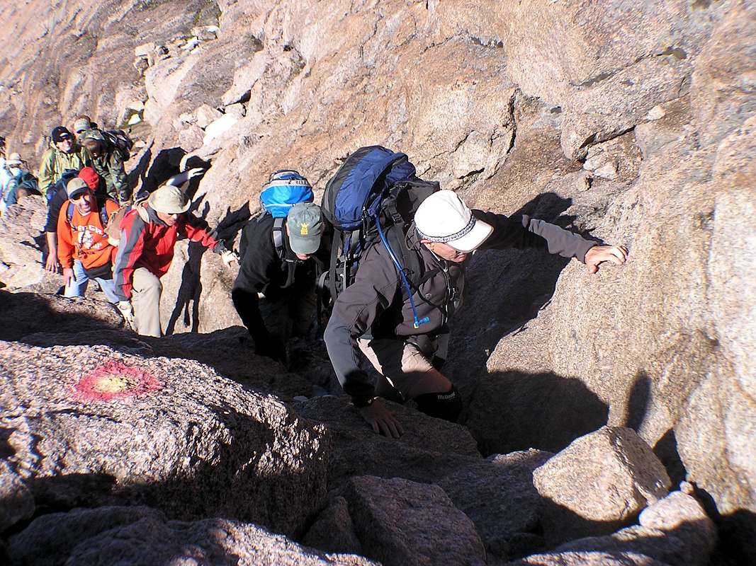
  • Crowds: since the Keyhole Route is the most popular hike of any Colorado 14er, in the summertime this peak can be overcrowded with people... sometimes as many as 100 at a time on the peak at once. The NPS estimates that 15,000 climb Longs Peak each year, most between mid-July and late-September. This creates long lines cueing up to go single file through the treacherous narrow passages ascending and descending. The crowds can also make securing a campsite quite difficult in the Boulderfield or anywhere near the TH (important for an early start).

Since the 1800s, there have been 55 recorded deaths on Longs Peak from such things as lightning, hypothermia, and falls due to winds, ice, and rocks breaking loose.

Longs Peak has been high on my to-do list for at least five years. Every time I visit Colorado, I’ve dreamed about summiting this mountain, but the timing and conditions have not been right… until yesterday, Friday the 13th of all days.

The Keyhole Route

The Keyhole Route is the “easiest” route to Longs Peak, but it is far from easy. It is not simply a hike but a strenuous trek across 7.5 miles of rough terrain and up 4800’ in elevation. The first 5.9 miles are a class-1 hike from 9400’ at the TH to 12,750’ at the “Boulderfield.” The Boulderfield ascends upward until you reach a notch in the mountain appropriately called “the Keyhole” at 13,150’. At the Keyhole, the route becomes a class-3 climb across narrow passages and up steep ravines for the last 1.3 miles of the trek.

The Keyhole provides access between the east and west sides of the mountain and the first sights of Glacier Gorge thousands of feet below. From the Keyhole to the summit, the route is marked with a series of red and yellow bull’s eyes painted on the rocks. From the Keyhole, the route traverses horizontally across a series of narrow ledges for roughly 500 yards until you come to “the Trough.”

The Trough (up and down) is a long, steep couloir which ascends skyward to 13,850’. At the top of the Trough, climbers have to carefully maneuver around a large impeding boulder to come around to the south side of the mountain and in view of the valley thousands of feet below.

The route then traverses across an exposed ledge appropriately called “the Narrows.” After the Narrows, the climb ascends sharply upward for 300’ in a couloir called “the Homestretch.” At the top of the Homestretch, you climb over a rock and surprisingly are suddenly in full view of the relatively flat summit for the first time.

My Ascent of Longs Peak

I arrived at the campground at the TH late on Thursday afternoon and was surprised to find plenty of campsites still available. I have to thank the NPS for this. They had a warning posted stating that Longs Peak was still a technical climb requiring crampons and ice axe due to snow and ice. But I knew from recent online reports and talking with hikers in the campground that snow and ice were not a problem on the Keyhole Route. Thanks to the NPS warning, I wouldn’t have to battle the crowds going to the top.

I wasn’t sure how long it would take me to summit this mountain, but I definitely wanted to be back below treeline before afternoon thunderstorms rolled in. So I decided to start out early.

I was on the trail at 4:45am with headlamp on. I passed individuals and groups who had started out earlier as I power-hiked upward through the trees and through the barren rocks above treeline. The sunrise to the east was gorgeous. Soon I found myself at the unmistakable place called the Boulderfield. I quickly hopped across the rocks and was at the Keyhole at 7:00am. Then I got scared. You have to understand that I’m a hiker, not a climber.

As I peered through the Keyhole, before me for the first time I saw the beginning of the narrow ledges I had read about. Underneath me was the beautiful Glacier Gorge dotted with mountain lakes thousands of feet below. A female climber who looked like she knew what she was doing (at least she had a rock climber’s helmet on) was the only person on the route ahead of me.

So I gritted my teeth and started off after her. I was thinking it would be wise to follow someone who knew what they were doing (or at least looked like she knew what she was doing). I told myself, just don’t look down (and I didn’t). But soon, my female climbing guide stopped and I ended up catching up to her and I had to pass her. I had no plans to spend any extra time taking breaks on this treacherous part of the climb. I wanted to get to the summit as soon as possible.

The farther I went, the more I became comfortable with the idea of traversing across narrow ledges with such high-altitude exposure below... but not comfortable enough to rid myself of white knuckles, gasping short breaths, twitching muscles, and a fear of looking down. I wish I could post some personal pictures of this experience, but I didn’t want to take my hands off the rocks long enough to fumble around in my backpack for my camera.

At “the Trough,” the route turned sharply skyward and became a bona fide climb. It was super-steep and seemed to go on forever. I kept telling myself... just make it to the next bull’s eye, just make it to the next bull’s eye. At many points, the route was so steep that I had to use all 4s to gradually pull myself up the route. Of course, since this was at over 13,000' the thin air doesn't help matters much.

I came upon a boulder that was particular tricky because there was barely enough space for a single individual to get around it with the added anxiousness of lots of exposure on these ledges. Slowly I eased myself around the massive rock.

As I came around this bend, two people who were descending told me that I was now in the Homestretch. Even though that's the actual name for this section, I think it’s a misnomer. What I didn't realize until then is that most of the Homestretch ascends steeply skyward also. It was an exhausting climb through this section, but I made good progress.

Then I came to a notch at the top and pulled myself up, and surprise, surprise, I was on top... the summit at last! Woo hoo! Mission accomplished. My 7th Colorado 14er! (except about an hour later I suddenly realized... uh oh, I’ve still gotta go back down!)

The summit surprised me because there was no indication it was just over the next rock. I strolled around on top and found the actual highpoint and about seven different geodeitic markers on various rocks.

I spent about an hour on top. I signed the log book and took some pictures. I ate my PB&J sandwiches for lunch, even though it was barely 8:30am... I went up a whole lot faster than I expected. I watched a marmot play in the distance. Then I took a nice nap... there's no better place on earth to take a nap than on a hard-earned mountain peak.

At first, there were only 3 of us on the peak. I was the 5th person up that Friday. Eventually, there were 5 of us which made a nice-sized gathering. The top of this peak was really odd. Basically, it was a remarkably level boulder field, but about the size of a football field. The weather could not have been more perfect... sunny, no clouds, 50s and virtually calm with no wind.

I knew more people would be coming up the narrows, the trough, the ledges, the homestretch, and all kinds of other places that I had other (unpostable) names for. I wanted to get down before meeting too many of them face to face in those places. I didn’t want to be anti-social, but those aren’t exactly the best places for a friendly get-together.

I looked around and suddenly wondered, how did I get up here? All the edges of the summit looked the same. Fortunately, I found that the NPS had posted a red sign for rubes like me who didn’t think ahead to remember where you came up. The sign indicated the proper place to begin the descent down the Homestretch.

So I started down. The descent was as treacherous for me as the ascent and took me nearly as long (at least to the Boulderfield). Now I had the extra bonus of seeing below all the places to which I could fall. Somehow I managed not to wear out the seat of my pants as I slowly slid down the rocks... but I now understood why those rocks were so slick.

When I got to the Keyhole, the winds had picked up. I was very glad that I gotten up and down the peak early in the day before I encountered any friendly breezes. I don’t think I would like to attempt this mountain in anything but perfect weather. Come to think of it, I’m not sure I’d like to attempt this mountain again in any weather.

After the Keyhole and the Boulderfield, it was soooo good to get back to the main trail on terra firma. I descended down the trail quite rapidly. At 12:45pm I was back at my car. Covering 15 miles and 4800’ of elevation gain going to/from Longs Peak was a wonderful way to spend 8 hours on a Friday.

Conclusion

On this trip to Colorado, Longs Peak wasn’t even on my agenda. But the timing and conditions worked out perfectly and I was finally able to conquer this monolith. Just 6 days earlier, I missed out on running the Leadville Trail Marathon due to a groin injury. Longs Peak was certainly a very nice consolation prize.

I can actually say that Longs Peak is the first 14er I've ever climbed (not hiked). It was definitely a climb. My arms were sore afterward. A class-3 climb with lots of exposure is not exactly my cup of tea, but I did it.

As I drove back through the RMNP to return to my family on the western side of the continental divide, I couldn't keep my eyes off of Longs Peak in the distance. It was surreal to think that I had just been up there.